
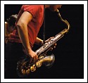
je poste suite à mon post sur toutes au 50.
j'ai entouré l'endroit de ma map, et je voudrais savoir si vous voyez comme moi ou non ?
je voulais faire la map exactement là je la vois faite (le fichier Jepg compressé souffre peut être un peu de la compression) sur le piton, pour reprendre le bon terme comme Cléophas l'a dit sur le post toutes au 50 et avoir l'anneau flou.
y suis-je arrivé ou est-ce mes yeux ?

Filename : DSC_0038.JPG
JFIF_APP1 : Exif
Main Information
Make : NIKON CORPORATION
Model : NIKON D80
XResolution : 300/1
YResolution : 300/1
ResolutionUnit : Inch
Software : Ver.1.00
DateTime : 2006:10:17 17:19:10
YCbCrPositioning : co-sited
ExifInfoOffset : 336
CustomRendered : Normal process
ExposureMode : Auto
WhiteBalance : Auto
DigitalZoomRatio : 1/1
FocalLength(35mm) : 75(mm)
SceneCaptureType : Standard
GainControl : None
Contrast : Soft
Saturation : Low
Sharpness : Hard
SubjectDistanceRange : Unknown
Sub Information
ExposureTime : 1/180Sec
FNumber : F2,0
ExposureProgram : Aperture Priority
ISOSpeedRatings : 320
ExifVersion : 0221
DateTimeOriginal : 2006:10:17 17:19:10
DateTimeDigitized : 2006:10:17 17:19:10
ComponentConfiguration : YCbCr
CompressedBitsPerPixel : 4/1 (bit/pixel)
ExposureBiasValue : EV-0,5
MaxApertureValue : F1,7
MeteringMode : Division
LightSource : Unidentified
Flash : Not fired
FocalLength : 50,00(mm)


 News
News